trap.nz New Traps overview page
Trap.nz is always looking for ways to help the usability of our product, to aid this the new trap overview page has been developed
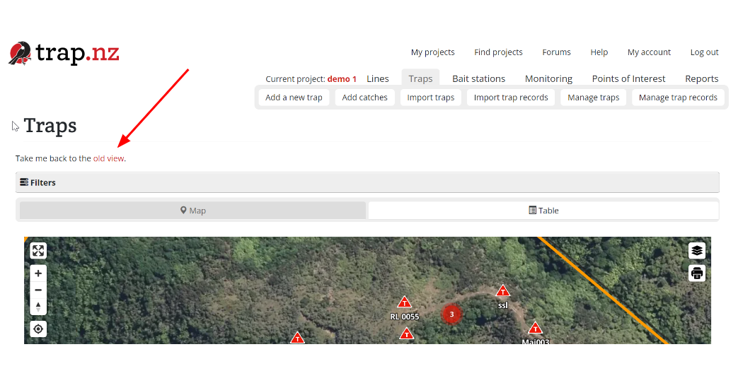
The first noticeable change is the filters section under the station tabs which is now collapsed by default, keeping them out of the way until you need them.
When you select the filters it opens up to allow you to select the options you are wanting to change
You can also switch between viewing traps as a map or table by selecting the tabs above the map
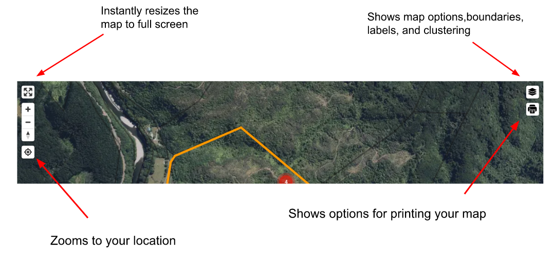
The new map has a variety of options that the old map didn’t.
You can now use your mouse to scroll in and out of the map.
The map shows overlapping traps as clusters by default, which makes the map easier to read and aids in navigation. Clicking a cluster will expand the traps inside it and zoom in to focus on them. You can toggle clustering and labels on and off using the layer controls.
The map will remember your selections in the layer controls whenever you return to the page..
You can now tilt the maps to suit your needs, this can be achieved in three ways
1 hold the ctrl key on your keyboard and use your mouse to tilt the map from various angles
2 right click and drag
3 on the trackpad of your laptop a two-finger click and drag
The map also shows road names when aerial hybrid and topographic are selected
The new trap icons
To align with the trap.nz mobile phone app the icons have been changed to
| trap |  |
| Sensor Trap - active |  |
| Sensor trap - active & sprung |  |
| Sensor trap - inactive |  |
Adding records
You can now quickly add a new trap record or edit a trap by clicking on the individual trap on the map
Or use the table to add records
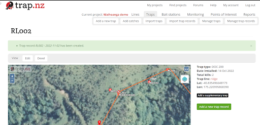
After you have entered the new trap records, you will be directed to the individual trap detail page, click the “trap” tab
You will be returned to the new trap overview, you can now select to return to the old trap overview page by clicking the link. (this is a temporary link until our members become familiar with the new trap overview page)


