
Accessing the Trap.NZ map feeds with ArcGIS
Accessing layers
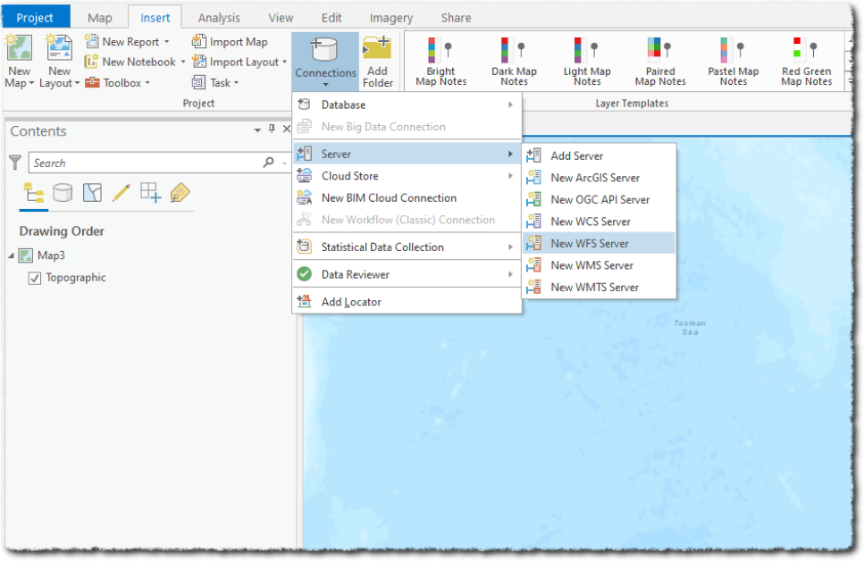
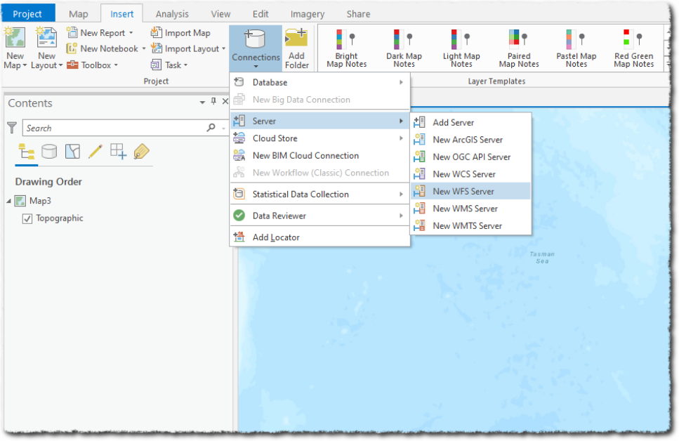
- You can add a new WFS Server via Connections > Server > New WFS Server:
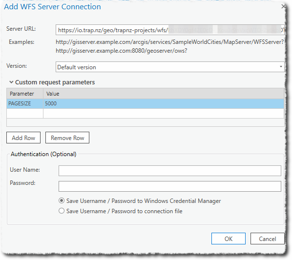
- Enter the WFS URL in the format as described here
https://io.trap.nz/geo/trapnz-projects/wfs/apikey/project_id - The WFS server is set to return a maximum of 10k features per request. Therefore you must set a page size value smaller than that. We suggest 5k to begin with. Add a custom request parameter of PAGESIZE, with a value of 5000
- Leave the Authentication options blank (we are using the API key to control access)
You will now see the available layers: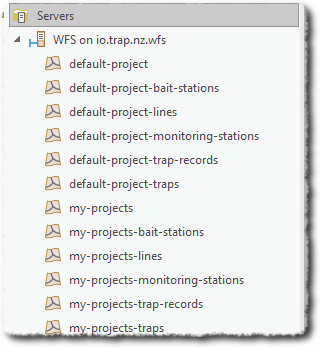
Working with the layers
Right-click or drag the layer to the map to see the features.
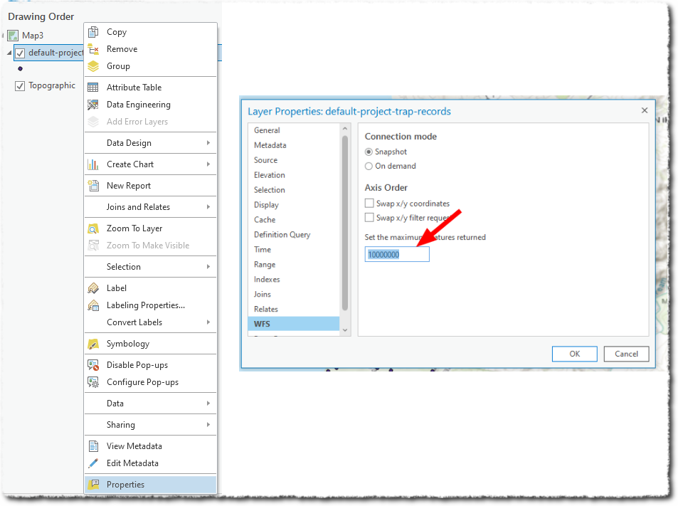
Note that, by default, ArcGIS only shows a maximum of 3000 features in the WFS layer. To change this, right-click the layers, select properties and then set the maximum features to something well above what you expect should be returned.
Filtering records
You can add a CQL filter to a WFS connection to filter features from the WSF server. This can be achieved by adding this parameter to the Custom request parameters - which can greatly reduce the amount of data retrieved (speeding up the transfer and improving performance).
For example - if you are only interested in this year’s records, you could add a CQL filter as a Custom request parameter
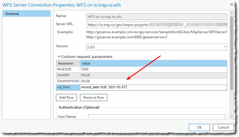
Add cql_filter as Parameter, and record_date %3E '2021-01-01' as Value.
Note: symbols such as ‘<’ and ‘>’ need to be URL encoded, hence the %3E in place of >